
Ascension Island is some 700 NM northwest of Saint Helena, of which it is a dependency. The administration does not encourage tourism, although for a fee a permit with strict requirements can be acquired in Jamestown. There are however severe restrictions on movement around the island. A number of different countries requiring the ultimate in security have set up a presence, and historically it has been a strategic mid-Atlantic base of great value particularly during World War 2 and the Falklands conflict. The RAF still have a station here, and other organizations to set up shop include the ESA with a spacecraft tracking station, NASA with a telescope monitoring orbital debris, British and American signals intelligence, and even the good old BBC.
Vessels heading for Canada, Bermuda, the Azores Islands or around the Azores high to Europe will find Ascension is very close to the recommended route. The island does see a number of vessels every southern-winter that are prepared to negotiate the permit requirements. Kiwi Roa was heading for Newfoundland so a look at the island from sea en route was planned. Ascension has no provision for small dinghy landing.
This collection of photos is spread over two pages. Boaters inspired by the following Photo Story should recognize that this is not a cruising guide nor navigational aid.
To Ascension
From Saint Helena, every mile north takes vessels out of the central South Atlantic trade winds and into progressively lighter air, so the sacrifice requires some consideration. Kiwi Roa ultimate destination was the top of the American continent, so Ascension is found close to the ideal route.

With only a small human presence in the middle of nowhere, the sea life is prolific, including a wide variety of bird life. Frigatebirds, white and sooty terns, tropic birds, boobies, gannets, skua, various petrels and the brown and black noddy – all were in evidence.

South East Head was raised in the early morning hours.

The north-east of the island is rocky, with dramatic cliffs meeting the ocean. We were headed around to the north-west, where the town is settled.

The coastal rock was inflamed by the dawn sun, a kaleidoscope of geology and colors.

We sailed the remaining miles along the northern coast under main only, escorted by bird life.

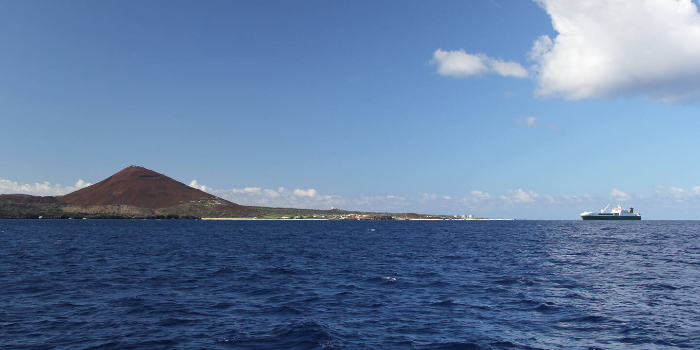
In more western parts of the island, flatter coastal land provides the more obvious settlement areas, and allowed us a view of the variety of technology towers which began to poke up above the landscape.

Inland, the central backdrop of Green Mountain loomed in the distance.

Ascension is less than a million years in age, and most of the landscape is still a volcanic wasteland.

Green Mountain was artificially forested, beginning in the 19th century, in largely successful efforts to increase rainfall for the human inhabitants. It’s now being conserved as a national park where native species are being reinstated.

As we made our way around the coast, more of the signs of technology surrounding Georgetown came into view.
