
Visiting Antarctica has been a lifelong dream of Peter’s, and Kiwi Roa was designed and built with the extreme environment in mind. Both the passage south from Cape Horn to the South Shetland Islands, and the Antarctic Peninsula itself is fraught with peril for the boater, with unpredictable weather, anchorages which barely qualify for the word, no available safe harbor to run to, and no support to speak of within any sort of practical range. As it turned out, we were mostly lucky with the weather, enduring only a few blows.
Like most boats making this trip, we prepared and provisioned in Ushuaia Argentina, but left the South American continent from Chile, as Puerto Williams permits a slightly more southerly starting block from which to spring south. This collection of photos is spread over multiple pages, and documents most of the areas visited.
Antarctica is one of the harshest environments on the planet, and any visit demands the upmost of careful preparation with an appropriate vessel, equipment, and crew. Boaters inspired by the following Photo Story should recognize that this is not a cruising guide nor navigational aid.
Drake Passage and landfall Antarctica
We had a varied passage south, leaving the Horn to the north. Weather ranged from fairly rough to flat calm, demanding some motor hours be run up. By any standards we were lucky.

Marine bird life was prominent all the way south, with a few petrels and albatrosses following us the entire way. Getting a good photo proved a challenge.

We sighted the South Shetlands on the fifth day.

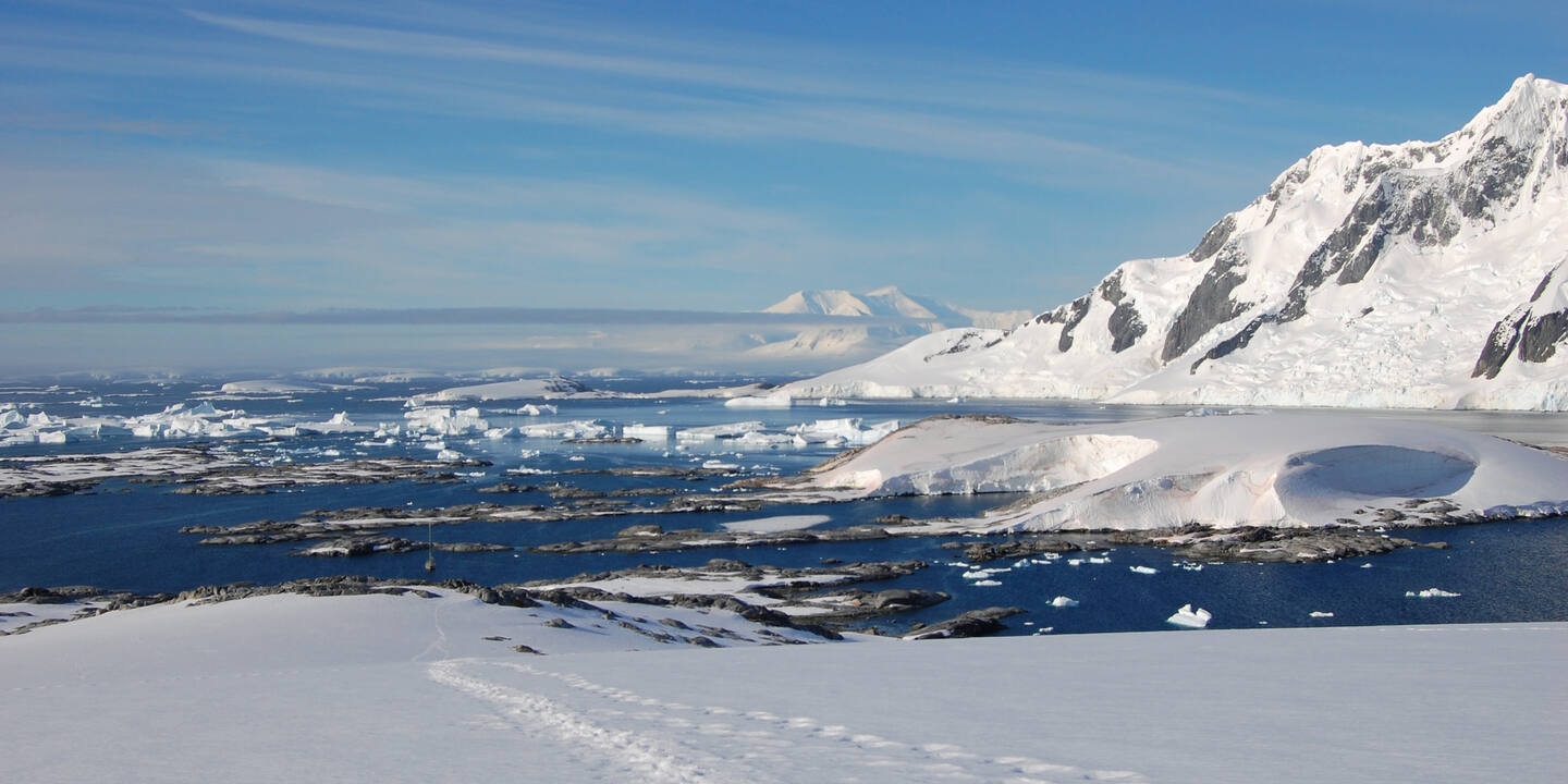
This is what landfall Antarctica looks like. The snow slopes and glaciers of the islands rise to perfect white mountain peaks, which remain for the most part obscured by clouds. The difficulty distinguishing mountain from cloud on the horizon became very common.

The terrain is very harsh and foreboding. It did not seem as though we were at all welcome, and the sense of isolation is heightened by an awareness of the unforgiving environment.

Any experienced seaman could be forgiven for feeling the urge to tuck tail, turn around, and head for the relative safety of the sea. We considered what it must have been like for the sailors of the ships of the whaling and surveying days, in this place which for the most part has not changed since their time. This thought was reinforced by the arrival of Europa, a Dutch barque dating from the early 1900s now used as a charter boat for tourists. She made landfall at the Aitcho Islands the morning after our own arrival, under full sail. A crew furling sails on the yard-arms of a tall-ship in Antarctica is really a sight to see (even if she does have a motor these days…).

With the scenic addition of a sailing ship for our viewing pleasure, it was time to turn our attention to the sights ashore. The Aitcho Islands are a group of tiny isles between Robert and Greenwich Islands, about halfway down the archipelago that makes up the South Shetlands. The name, from some surveyor’s wit, is in honor of the British H.O. (Hydrographic Office).

Yes, penguins.

This island is practically covered in gentoo and chinstrap penguins. This far north, their chicks are born earlier and so we see them at a fairly well developed stage.

They are remarkably unafraid of humans, and show no sign of distress unless you really make excited movements or get too close.

That’s enough penguin pictures for now. There’ll be more later.
