
On Peter’s North Atlantic chart the western seaboard of North America leaned over Kiwi Roa’s course, marked in daily positions, as she climbed northeast. Like the overhang of a cliff, Nova Scotia and Newfoundland loomed above while North Atlantic weather tried its best to hamper our efforts to reach the top. This was the first real land contacted since departing Ascension Island some 39 days and 4,500 miles prior, a radical shift in environment from Africa and the sub-tropics. Back into the high latitudes, but this time the northern version.
The depressions, fronts, and heavy swells over the Grand Banks gave way to calmer seas and quiet fog that extended four days’ worth of motoring away from the coast. The fog was a dense mixture of mist and precipitation, and navigation was reduced to an affixation with the radar, then a certain paranoia attached to the directional fog horns of buoys and ships.
St John’s
A Canadian Coast Guard ship with a large trawler on a long tow-line materialized behind us.

At the same time, a line of cliffs, broken by rocky beaches lined by trapped ice in front of small settlements receding upslope under ridgelines of pine trees.

Still early morning, the cliffs were decorated by voluminous fog, truly sea level clouds that diffused light from the occluded sun into a brilliant white only bettered by the blue-white of orphaned and grounded bergs.

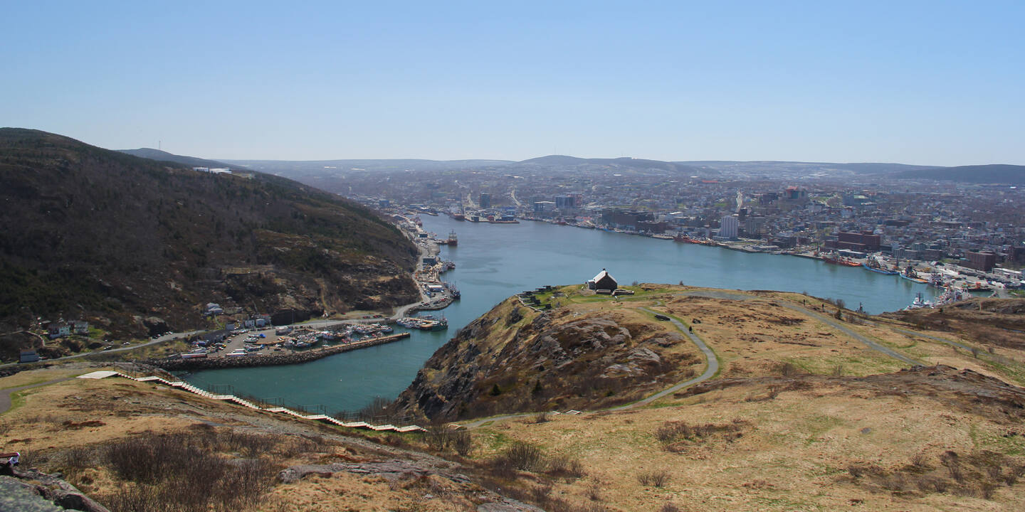
The VHF began to talk in unusual accents about traversing “the Narrows”. High cliffs parted to display civilization beyond: a fully enclosed harbour to delight any sailor, lined by long docks of commercial shipping with a backdrop of office blocks and apartment buildings. Here at the absolute eastern extremity of Newfoundland was St John’s, the largest city in the province.

Harbour Control directs traffic through the Narrows, and Kiwi Roa was duly directed into a queue. Inside, we had researched a destination at the Queen’s Wharf, which turned out to be two small floating docks, just enough space on a side for 15 meter (52′) Kiwi Roa – no anchoring in the harbour.

Ashore, St John’s is one of the New World’s oldest settlements, founded in the late 15th century, with a history of fishing, war, and in more modern times oil exploration.

On the northern side of the Narrows is Signal Hill, upon the summit of which stands Cabot Tower, an icon of the region.

Fortifications and guns guarding against the French, and more lately the Germans, were installed around the hill throughout most of its settled history, but it was named for its more prosaic purpose: flag signalling between town and sea, a practice continued well into the modern era. In time the hill was used for the occasional communications break through – the first transatlantic wireless transmission, sent from Cornwall; later, one of the earliest voice transmissions radioed from a ship leaving England.

Outside the Narrows, huge icebergs broken away from the pack ice north run themselves aground, looking from inside the harbour as if they block its entrance.

These particularly large ones suck heat from the environment as they endure, lowering the water and air temperatures inside the harbour by as much as several degrees.

In contrast was the welcome we found from the local Newfies, always warm and hospitable. A friend loaned us a mobile phone, and Peter took the opportunity of the town’s marine industry to install an AIS system as another aid to watch-keeping.